
If we have to define it, the world map is a cartographic representation of the entire earth. A perfect way to discover all the corners of it. In this way, we can choose different types of world map. From the physicist who will teach us both the rivers and the mountain ranges, to the politician who shows us the divisions of territories in the form of countries or provinces.
Es one of the most used methods in education. Because in this way, children will get a little closer to the world around them. Valuable information that they will expand throughout their lives. If we look back, perhaps you still have some of the world maps that you have used, traced or bought. Although if not, do not worry because today you will return to childhood thanks to all the data that we tell you.
Political world map

One of the types of world map most used by all, is called political world map. Why? Well, because in it we could see the different countries as well as continents or provinces. All of them are shown in color so that you can see their limitations. Broadly speaking, we can say that the political map will show us the territorial borders. A perfect map to study these territories and locate them at first glance.
Each country will have a color and the lines of its division will be the political borders. This type of map can also have additional information in the form of roads or other communication routes. For their study, it is one of the main maps, since students will be able to discover where each country is. A way to study them visually. Thanks to the colors, the students will be able to identify each zone. Of course, this is where visual memory comes in since in addition to the mentioned color, they will have to memorize the name. Once you have this combination, you must translate it into a silent map.
To start with the study, you can always opt for a political world map that is colored according to the continents. In this way, there are fewer colors and fewer names to consider. Once this is well practiced, you can go to the complete map, where you will see what we have mentioned above in terms of divisions of territory and therefore, colors.
To download - Political world map
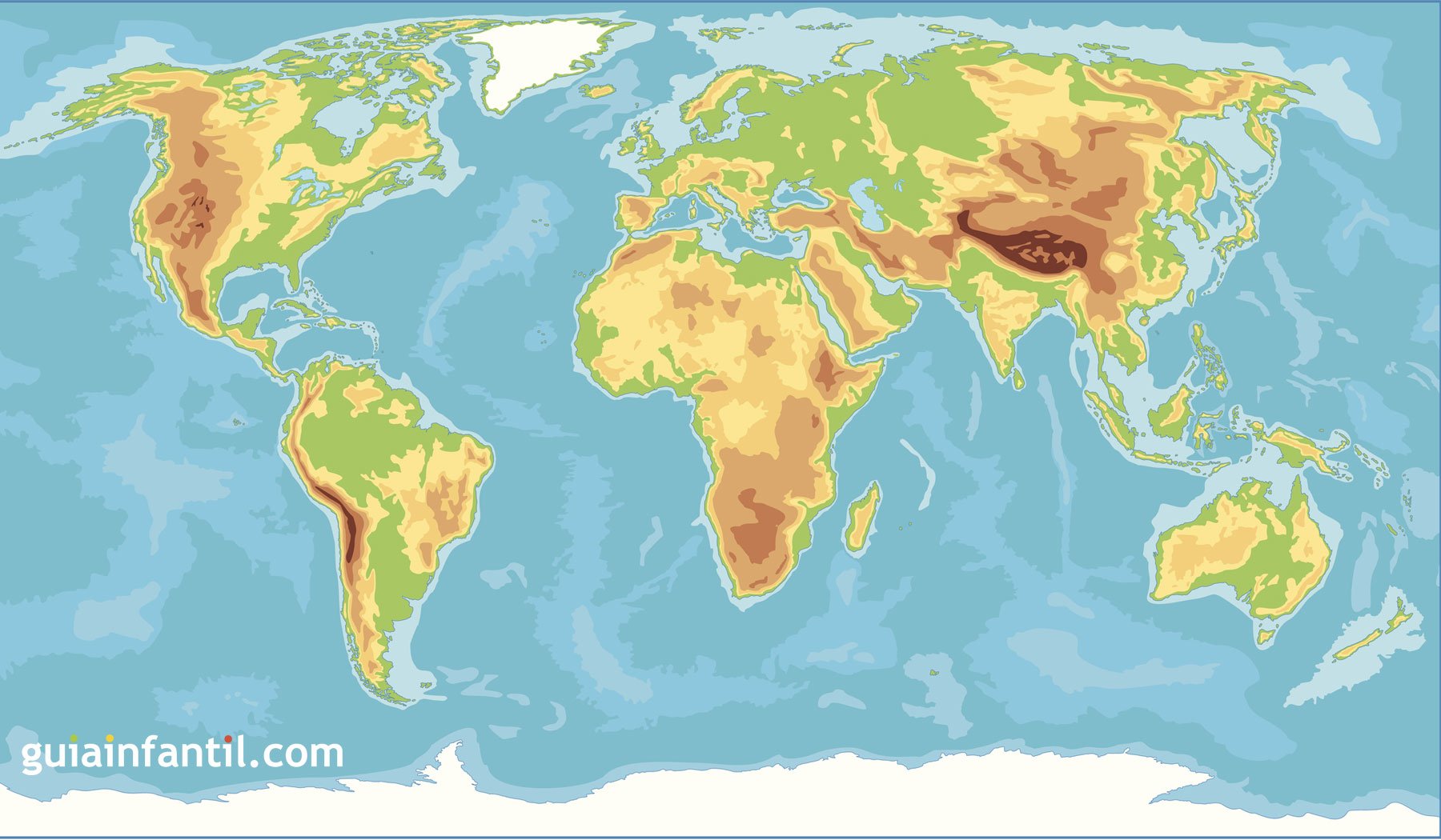
Physical world map

When we talk about physical world map, we put aside countries as such, to delve a little deeper into landforms. As such, we will study the rivers or the seas, they are forgetting the mountain ranges, the jungles and even the deserts. All of them are a set of physical characteristics that the earth has, as such, we must also know them. Undoubtedly, these types of maps differ from political ones because they are made on a scale. They do not have the striking colors of the previous ones, but rather focus on browns, greens and blues.
When studying them, it is always advisable to go by parts. Because although the political map already has some difficulty when it comes to memorizing it, the physicist is not far behind. Perhaps the best solution for more successful learning is to start with each continent. We can go making a division and studying in parts.
Once we have memorized both the mountain ranges and the seas of each continent, then we will move on to the next one. In order to be able to capture our knowledge, it is necessary to mention the silent maps again. Because it is not knowing all the data by heart, but rather being able to capture it on a map.
To download - Physical world map
Mute world map

As its name indicates, the silent world map you will not provide us with any information. Because in this case, we will be the ones who have to write it about him. You can find both political and physical silent world maps. A way to delimit the areas but only you will have to name them. It is one of the perfect maps for students to put their studies to the test. Some of them have brushstrokes of color, especially in the physical, so that we can better locate the geographical features. Although when it comes to being able to practice we must always dare with a totally blank map. Only then will we put our memory to the test!
Download Mute World Map - Political | Dumb
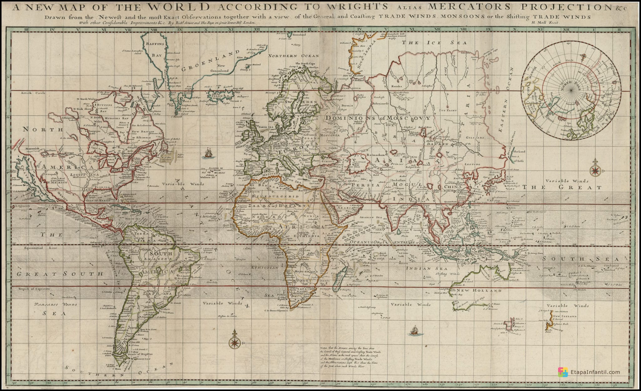
Ancient world map

Without a doubt, the old world map is another type to consider. It's a perfect way to brush up on history. It is a map that shows us the social and political distribution of yesteryear. That is, it can include countries or places that no longer exist as such. Some span the world since classical antiquity until the most modern age.
- Ptolemy world map: Based on a book that was written in the year 150.
- Macrobio World Map: Another of the most important and influential. It is a terrestrial sphere that is divided into climatic zones.
- World map of Beatus of Liébana: Dates from 776 and has an approximate view of the world.
To download - Ancient world map
World map europe
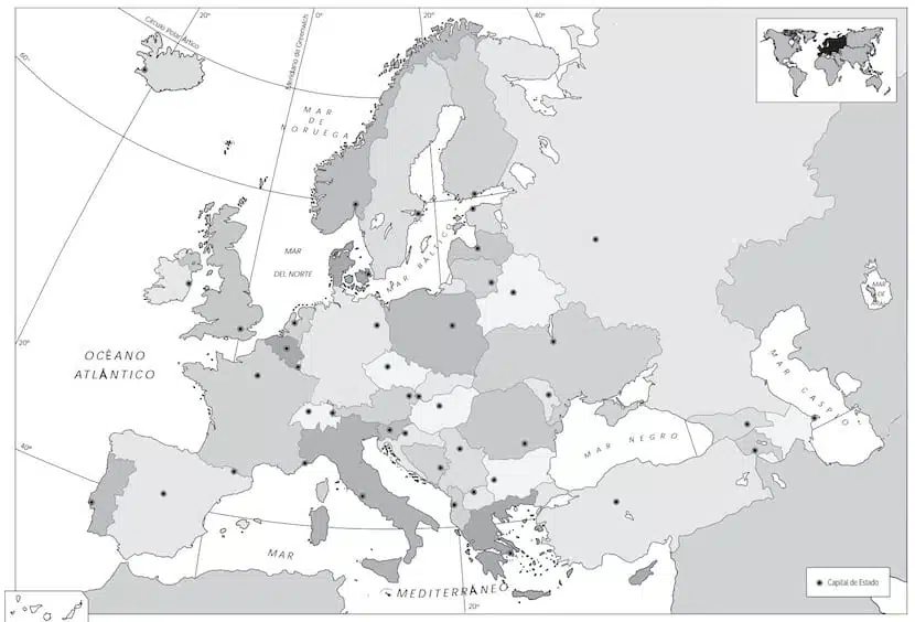
When it comes to having to study and better understand each corner of the world, it is best to memorize it in parts. Hence one of them will be the world map of europe. A way to start with our neighbors, their borders, their names and of course, the geographical features by which they are composed.
Download world map Europe - Relief | Political
World map for coloring

El world map coloring It is a perfect tool for children. In addition to learning the distribution of countries or continents, seas and oceans, they will also be motivated a little more. Something that is vital when it comes to learning. Hence, when they are asked to color the maps, they will discover that it is not as boring as it might seem.
What are the advantages of a world map for coloring? Well, we can mention several, but one of the most important is that it will improve dexterity and also coordination in children. In addition, they will continue to develop their thinking, although in this case in addition to the logical one, we would have to mention the abstract. They will get a great idea of what the world and its main parts are, just by looking at it and coloring it. Without a doubt, another advantage is that it will stimulate your concentration and enhance learning in general. In order to capture all these types of advantages, it is best to do it on political world maps. A perfect way to distribute the colors of their choice over the countries that they will later study. You have the tools both in digital form and on paper, according to the needs of each one.
To download - World map for coloring
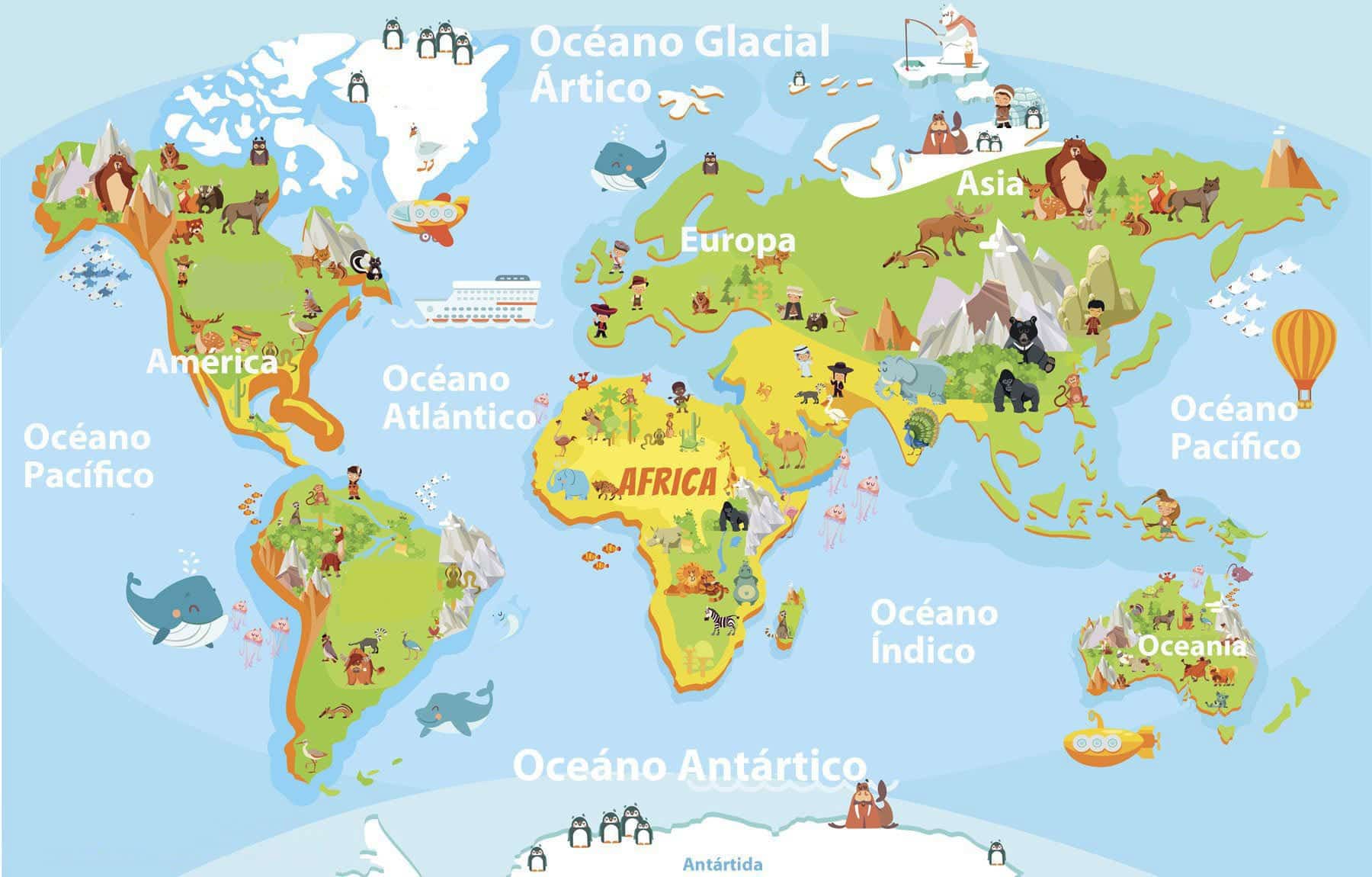
World map for children

Although from a very young age we began to get familiar with the maps, it is advisable to adapt them to each age. More than anything because if we talk about young children, it is not necessary for them to study details that they will when they are older. But what we must do is introduce them to this matter. That is why there are world maps for children.
A perfect alternative for the little ones in the house to enjoy while learning and having fun. So get the idea that for them, it is best to start with the basics. The continents and the oceans will be two of the data that they will memorize. Here we can play a lot both with colors and opting for funny maps, with drawings of animals or traditions. Everything serves to make motivation and entertainment come together to provide information to the little ones. In this section, you can also print them or let them have fun with new technologies.
To download - World map for children